
Heavy rain warnings return to B.C. as flood recovery continues across the Lower Mainland
Lucas Tremblay
12/16/20252 min read
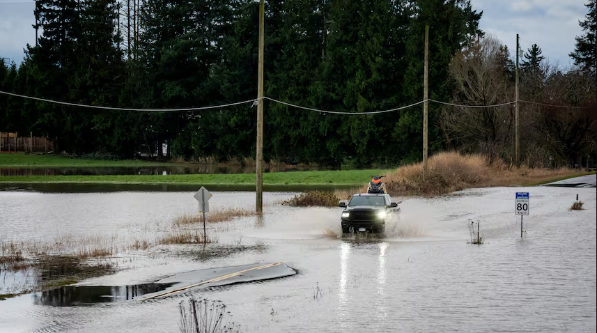
Another round of heavy rain is moving into southwestern British Columbia, prompting renewed rainfall warnings as communities continue to recover from last week’s widespread flooding.
Environment Canada says up to 70 millimetres of rain could fall across Metro Vancouver and the Fraser Valley between Tuesday and early Wednesday, raising concerns about flooding in already saturated areas.
The latest storm follows intense rainfall last week that flooded homes and farms, forced evacuations and shut down major transportation routes across the Fraser Valley.
As of Tuesday, officials report:
36 properties in Abbotsford remain under evacuation order, with 449 more on evacuation alert.
More than 8,000 BC Hydro customers are still without power.
Highway 3 between Hope and Manning Park remains closed due to landslide damage.
The Sumas border crossing is open to passenger vehicles but closed to commercial traffic.
Floodwaters that flowed north from Washington state’s Nooksack River have begun to recede, allowing cleanup efforts to start in parts of the Fraser Valley. However, the flood threat remains elevated for several rivers and has expanded to include areas of Metro Vancouver’s North Shore.
Emergency Management Minister Kelly Greene warned that the renewed rainfall increases the risk of both flooding and landslides, particularly in mountainous and low-lying regions.
She urged residents to stay away from rivers and creeks, noting that high water levels can destabilize riverbanks even after rainfall eases.
Power restoration efforts are ongoing across the province. BC Hydro says crews have significantly reduced outages since Monday, when more than 90,000 customers were without electricity at the peak of the storm. Squamish, Duncan and Hope were among the hardest-hit communities.
Unseasonably warm temperatures have compounded the situation. Environment Canada data shows more than two dozen B.C. communities set daily temperature records on Monday, accelerating snowmelt at higher elevations.
Kamloops reached 18.6 C, breaking a record set in 1962, while Victoria International Airport hit 16.8 C, surpassing its previous high from 1999.
Rainfall totals from the previous storm were also extreme, with 190 millimetres recorded in Squamish and 163 millimetres in Zeballos on northwest Vancouver Island.
Officials continue to urge caution as the weather system moves through, warning that conditions can change rapidly and recovery efforts may be disrupted by renewed flooding and infrastructure damage.
News
Stay updated with the latest BC news stories, subscribe to our newsletter today.
SUBSCRIBE
© 2026 Innovatory Labs Inc. All rights reserved.
LINKS