
Freezing Rain and Winter Storm Warnings Issued for Northern B.C. After Heavy Snowfall
Olivia Singh
12/2/20241 min read
Northern British Columbia is under several weather warnings as freezing rain, heavy snowfall, and strong winds continue to affect the region following a weekend of intense winter storms.
Freezing Rain Alerts
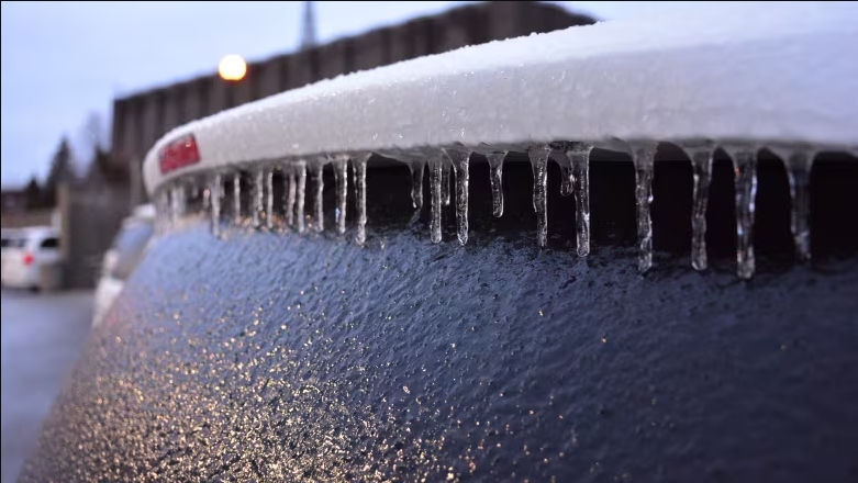
Freezing rain warnings are in place for the north and south Peace River, Bulkley Valley, Fort Nelson, Lakes District, and Stuart-Nechako regions. Environment Canada warns that freezing rain will persist into Monday afternoon, creating hazardous travel conditions on highways, roads, walkways, and parking lots.
The agency also cautions that ice accumulation could lead to power outages and fallen tree branches. Residents are urged to exercise caution and prepare for potential disruptions.
Snowfall Warnings
The Cassiar Mountains, Teslin, and Watson Lake regions are expected to see between 15 and 35 centimetres of snow by Monday night. Over the weekend, some parts of the Terrace area received as much as 50 centimetres of snow, further complicating travel and local conditions.
Winter Storm Warning
Inland areas of the North Coast are under a winter storm warning, with up to 40 centimetres of snow predicted Monday. Snow will later transition into a mix of snow and rain before changing to heavy rain, accompanied by a slight risk of freezing rain during the transition.
Coastal regions are bracing for as much as 150 millimetres of rain by Wednesday morning, along with southeast winds of up to 80 km/h, gusting to 100 km/h in exposed areas. Environment Canada warns of possible flooding in low-lying areas, slushy conditions, and travel delays.
Preparation and Safety
Environment Canada urges residents to monitor local forecasts and prepare for rapidly changing conditions. Travelers are advised to carry emergency kits, avoid non-essential travel in affected areas, and check for updates on road closures and weather developments.
News
Stay updated with the latest BC news stories, subscribe to our newsletter today.
SUBSCRIBE
© 2026 Innovatory Labs Inc. All rights reserved.
LINKS